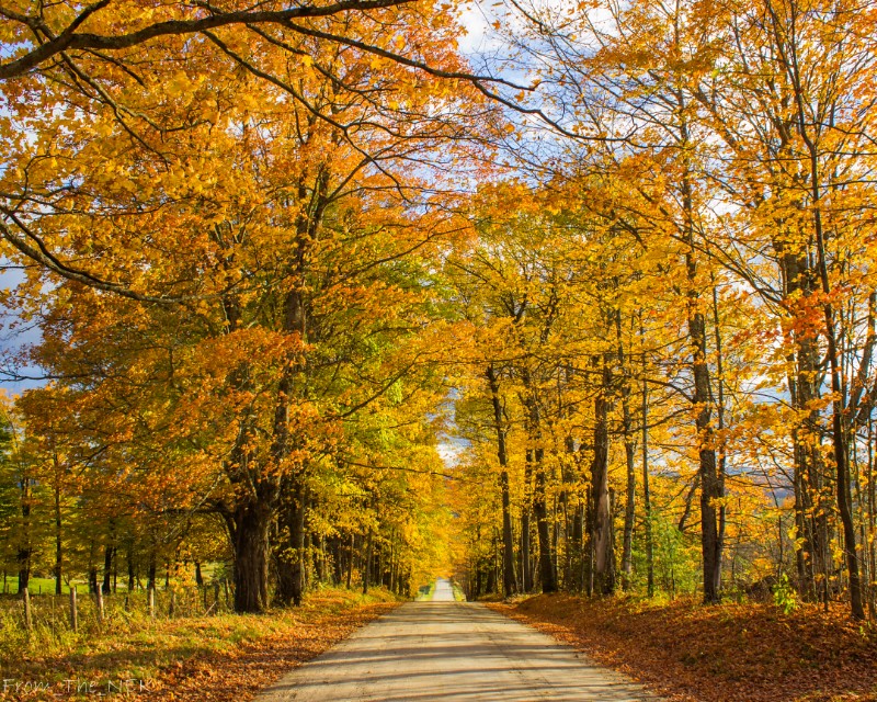
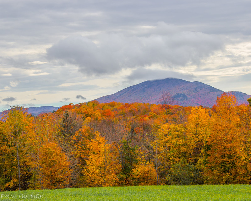
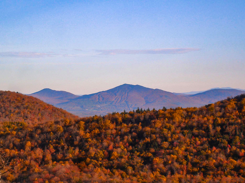
THE BEST OF VERMONT; Scenic Drives, Viewpoints, Ponds, Lakes, Streams, Bridges and Buildings

Discuss Fall Foliage in Vermont, when to come, where to stay, where to take a tour etc. Note: You must be registered in order to post. If you have trouble registering, use the contact us form on Scenes of Vermont's home page.

Moderators: Andy, pwt54, admin, ctyanky

From_the_NEK
Posts: 377
Joined: Wed Sep 16, 2009 9:39 am
Location: Lyndonville, VT

Post: # 9105Post From_the_NEK
Wed Sep 16, 2009 4:40 pm

Scenic Drive, DRIVING ROUTE - Loop through the central Northeast Kingdom "NEK Central"

Google Directions: http://g.co/maps/te5xt
Google directions without Wheeler Mtn Rd: http://goo.gl/maps/KHFa4
Google Directions without Wheeler Mtn Rd but with all optional offshoots (May Pond, Lake Willoughby South Beach, Island Pond, Burke Mtn Toll Road): https://goo.gl/maps/C54KRpQ1Ab82

Living in the Northeast Kingdom, I could go on for ever about the various routes that provide great foliage viewing. Here is one of my favorites.

Note: This route is rather complex and involves quite a bit of gravel road driving (which in my opinion is where the best viewing is found). However, if you're up for trying it, I think you'll find it much better than traveling through the valleys of the NEK which is where the major paved roads keep you.

Distance: 60 miles
Driving Time: 2 hrs 15 minutes (obviously longer if you stop to take pictures :D )
Recommended time frame: Late September - 1st week of October

Starting point:
Lyndonville - Colonnade Inn parking lot (off exit 23 of I-91)

Take a right out of the parking lot onto the Back Center Rd (as you proceed along this road there are very nice views toward town with Burke Mtn as a backdrop, and there is also a horse ranch as well).

At the stop sign, continue straight through the intersection onto Center St (you will pass through the campus of Lyndon Institute, a semi-private high school that may have a football game in progress). You will then pass through the Miller's Run covered bridge before intersecting with VT122.

Turn left at the stop sign onto VT122 and IMMEDIATELY turn right onto Lower Pudding Hill Rd (there are a lot of good views to the East toward Burke Mtn along this road.
Image

<Optional detour>: Immediately after the airport, turn left on Airport Rd and then right on Old Coach Rd, a dead end side road off of Pudding Hill Rd 1.5 mile long detour with views like this -
Image

And this -
Image
<end optional detour>

Back on Pudding Hill Rd, at the top of the hill {3.5 miles} there are outstanding views toward Burke and to the south down the Passumpsic River valley.


Continue on another .4 miles to a grand vista northwest to Willoughby Gap, north to hilltop farms and Bald Mtn, east to Burke Mtn.

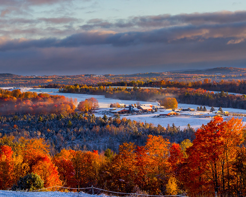
Image

Image

Image

Just down the hill from the northerly vista, turn left onto S Ridge Rd. Bear right onto Wheelock Rd and follow it into "downtown" Sutton (keep an eye out for nice little white church). At the Fire Station, turn left onto Underpass Rd. There are multiple great vistas along this road.

Continue on Underpass Rd until it ends at US Route 5.

Turn left on US RT5.

Option:
Travel 1.6 miles and turn right on Wheeler Mtn Rd.
Wheeler Mtn Rd provides you with a great secluded pond and access to a great hike (Wheeler Mtn) if you wish to do so. South view from the top of Wheeler Mtn in 2007:
Image
East View (Burke Mtn):
Image

[NOTE: This is a rather rough road in spots. You may want to bypass this by continuing on Route 5 to Barton.


If bypassing Wheeler Mtn, continue to Barton and turn right on VT16 (Eastern Av). This will bring you past the north end of Crystal Lake. May Pond is a nice side trip off this option as well.]

Turn Right on Cook Rd and then turn onto Peene Hill Rd.
Bear right onto N Beach Rd (VT16). This brings you to the North Beach of Lake Willoughby.

Bear right onto Route 5A for 1 mile. {Option: Follow Route 5A to the south end of Lake Willoughby for more great views, then go back north to Hinton Hill Rd}
Image

Turn Left onto Hinton Hill Rd. If it is a very clear day, at 1.6 miles up the hill, keep an eye out behind you for an amazing view stretching Southwest to Mt Mansfield and Camels Hump. Bear left to stay on Hinton Hill Rd.

Bear Left onto Westmore Rd for 1.2 miles

Turn Right on Hudson Rd for .3 miles

Turn Right on VT105 for 3.2 miles
(Option: stay on 105 for a couple of miles if you want to go to Island Pond. Return to the main route the way you came.).

Turn Right on VT114 for .75 miles

Turn Right on Newark Rd. This will become Abbott Hill Rd and then Newark St. Look for the Jobs Pond turn off on the right 3.25 miles up the road.

11 miles after turning onto Newark Rd, turn left onto Sugarhouse Rd where you will immediately be in the middle of a sugarbush.
Image

Continue for 2.1 miles and bear left onto Burke Hollow Rd for .65 miles.

Turn Right onto Darling Hill Rd (at the top of the hill) for 5.6 miles. You will pass several attractive Inns and farms along this very scenic ridgeline.
(option: Burke Mtn Toll Road ($5 per car). After a couple of miles on Darling Hill Rd, keep your eye out for East Darling Hill Rd on your left. Take this down the hill into East Burke Village and head up toward Burke Mtn. Return to the main route on Darling Hill the way you came.).

Turn Right onto VT114 for .5 miles

Turn Left at the light onto US Route 5 for 2 miles. Keep an eye out on your right for the park in the middle of town. This can have good foliage later in the season if the hills are already past. Arrive at your starting point, the Colonnade Inn, is on your right.


Please note there are so many options off of this route it is hard to list them all. The Burke Mtn Toll Rd provides outstanding views across northern Vermont and New Hampshire from the fire tower. The road is paved to the the summit and the fire tower is a .2 mile walk from the parking lot. This is recommended if the morning is very foggy. Often an early morning drive up the toll road can get you up above the low level fog for some beautiful views.

Edited: 8/20/10 fixed picture link and updated Burke Mtn toll road price
Edited: 9/27/11 for revised content and photos
Edit: 9/11/13 for content and added Google direction that route around Wheeler Mtn Rd
Edited: 8/17/16 for revised content and photos
Edited: 9-19-19 to fix photos links that Photobucket broke
Last edited by From_the_NEK on Thu Sep 19, 2019 11:33 am, edited 22 times in total.


pwt54
Moderator
Posts: 2747
Joined: Sat Jun 01, 2002 12:01 am
Location: johnson,vermont,usa

Rutland to Pawlett

Post: # 9114Post pwt54
Wed Sep 16, 2009 9:23 pm

A favorite ride of mine is route 133 south from West Rutland to the end at route 30 in Pawlet. Turn right onto route 30 north and drive that to Poultney. There I pick up route 140 east and drive that to the end at route 103 in East Wallingford. Great roads and good color. Right now the leaf-peepers have not discovered these road, so traffic will be light.

Aspen
Posts: 282
Joined: Sat Sep 24, 2005 12:01 am

Middlebury Gap and back via Brandon Gap

Post: # 9115Post Aspen
Wed Sep 16, 2009 10:59 pm

From Scenic Route 100 in Hancock,
turn onto Route 125 West (Middlebury Gap)
Drive the entire Middlebury Gap to Middlebury
Return to Route 100 via Brandon Gap which is Route 73

Scenes to watch for on the Middlebury Gap are:
Texas Falls (stop to see if reopened following maintenance due to storm damage)
Bread Loaf Inn (beautiful yellow buildings)
Turnoff onto dirt road to Robert Frost Cabin
Robert Frost Wayside picnic area
Awesome mountain views

Note: There are 4 beautiful gaps
to loop from Scenic Route 100 and back!

Enjoy a drive down one gap and return via a different gap.

Middlebury Gap (Route 125)
Brandon Gap (Route 73)
Appalachian Gap (Route 17)
Lincoln Gap (not suitable for trailers and RVs)

Andy
Posts: 1562
Joined: Sun Sep 18, 2005 12:01 am
Location: Saginaw, Michigan
Contact:

Post: # 9130Post Andy
Thu Sep 17, 2009 5:09 pm

Aspen wrote:Calling Ctyanky, PWT, Andy, Wentworth, Abby, MMVT, Admin, BM and ALL other regulars and NEWCOMERS to post some of your past and present recommended driving routes in Vermont to this thread.
Agree, many have already shared wonderful Vermont driving routes. New .....
Maybe its time to set up a permanent "Sticky" thread that just has "PWT" style loops?

Edit: O.K. - I made it "sticky."

For those who already posted a route(s), If you didn't do so, please go back, hit the edit button and put a Subject Line in that tells the general area the loop covers. Thanks. :)
Andy

If it sounds too good to be true, its probably . . . .

wentworth
Posts: 549
Joined: Wed Sep 05, 2007 9:56 pm

Post: # 9184Post wentworth
Fri Sep 18, 2009 8:44 pm

NEK, love hat top picture of yours--Rt.108 just north of Stowe thru Smugglers Notch is a must for Newcomers--and the Stowe Toll Rd is just off 108, to the west---Googled LINCOLN GAP and it said DeathRide lol, so we'll definitely hit that one, off Rt.100 in Warren,to the west to Lincoln
Last edited by wentworth on Fri Sep 18, 2009 8:48 pm, edited 1 time in total.


wentworth
Posts: 549
Joined: Wed Sep 05, 2007 9:56 pm

Re: Woodstock area-Cloudland Road

Post: # 9187Post wentworth
Fri Sep 18, 2009 8:51 pm

mmvt wrote:this is a cut and paste from a previous post (PWT, I think - apologies if I'm wrong)
Cloudland Road

The Cloudland Road is a great ride all by itself. This is low hill country with lots of hilltop farms. Lots of open fields with long views. To find the Cloudland Road, drive route 12 north out of Woodstock to the River Road, next to the Billing's Farm Museum, and turn right onto the River Road. Drive that until you come to the Cloudland Road on the left side.
--thanks mmvt, that's near Pomfret--We're going to hit that one also

Monna
Posts: 12
Joined: Wed Sep 16, 2009 9:43 am
Contact:

Post: # 9352Post Monna
Tue Sep 22, 2009 8:59 pm

Thank you all for pronominal forum info ya guys have here, the info ya guys provide is priceless, I/m looking forward to my trip next week, and I'll definably post back with all the pictures:)

pwt54
Moderator
Posts: 2747
Joined: Sat Jun 01, 2002 12:01 am
Location: johnson,vermont,usa

Post: # 9358Post pwt54
Wed Sep 23, 2009 9:16 am

The Northeast Kingdom is progressing nicely. Route 100 between Hyde Park and Lowell will have the best color. Reports on the radio say the colors in the highlands around Glover and Barton are looking good.

faxmachineanthem
Posts: 160
Joined: Tue Jun 09, 2009 11:11 am

Post: # 9421Post faxmachineanthem
Thu Sep 24, 2009 3:35 pm

I did my best to map this out on Google maps if anybody else is interested. You can even send the route to your GPS. Looks like a good one, thanks NEK!


http://maps.google.com/maps?f=d&source= ... 17294&z=11


From_the_NEK wrote:Loop through the central Northeast Kingdom

Living in the Northeast Kingdom, I could go on for ever about the various routes that provide great foliage viewing. Here is one of my favorites.

Note: This route is rather complex and involves quite a bit of gravel road driving (which in my opinion is where the best viewing is found). However. if you're up for trying it, I think you'll find it much better that traveling through the valleys of the NEK which is where the major paved roads keep you.

pwt54
Moderator
Posts: 2747
Joined: Sat Jun 01, 2002 12:01 am
Location: johnson,vermont,usa

Post: # 9440Post pwt54
Thu Sep 24, 2009 6:20 pm

If you do the Abbott Hill Road, look for a sign for the Jobs Pond boat access road and take it to the pond. There is quite a view there. If the red maples are peaking below the cliff it makes a great photo.

ixl
Posts: 938
Joined: Wed Oct 08, 2003 12:01 am
Location: Southern VT
Contact:

Post: # 9456Post ixl
Thu Sep 24, 2009 7:01 pm

Just a quick note to add in that Route 9 from Brattleboro to Bennington is a great ride if you've not done it before, and from what I can see here in the valley, should be getting very nice color-wise this weekend.

Also worthwhile is Kelly Stand Road, a winding dirt road at the higher elevations going between Stratton and Arlington.
Charles Kozierok - DesktopScenes.com

View Autumn Scenes from Southern Vermont (2003), my free, 75-image foliage gallery!

Aspen
Posts: 282
Joined: Sat Sep 24, 2005 12:01 am

Jeffersonville/Johnson (18 mile loop)

Post: # 9617Post Aspen
Mon Sep 28, 2009 10:37 am

One morning, my husband and I drove from Stowe in 2005 to the Jeffersonville and Johnson areas of Vermont, looking for covered bridges. We made a wrong turn onto a beautiful dirt road that followed a river. After our visit to Vermont, mentioned this beautiful drive on a dirt road along a river on this forum. PWT believed we drove along the Lamoille River.

Below is an 18 mile loop drive which goes along the Lamoille River and is officially listed in our tenth edition of Vermont: An Explorer's Guide by Christina Tree & Sally W. Johnson (12th edition is out now)

Jeffersonville/Johnson (18 mile loop)
From the junction of Routes 15 and 108, head north on Route 108, but turn onto Route 109 (note the Poland Covered Bridge on your right) Take your first right, Hogback Road, which shadows the north bank of the Lamoille River most of the way into Johnson. Return via Route 15.

Aspen

Andy
Posts: 1562
Joined: Sun Sep 18, 2005 12:01 am
Location: Saginaw, Michigan
Contact:

Post: # 9618Post Andy
Mon Sep 28, 2009 10:57 am

Aspen: My old "stomping grounds." I lived in Bakersfield (about 8 miles north on 108 from this junction). I went to church every Sunday and Wednesday night in Waterville (if you continue on 109 instead of turning onto the hogback, you come to Waterville -- a couple nice, covered bridges through town). I have driven this route many, many times and have to agree with the Explorer's guide. Its as good as any route anywhere I have ever driven for views, any time of the year. Fall foliage is the icing.
Andy

If it sounds too good to be true, its probably . . . .

scurtis623
Posts: 51
Joined: Fri Oct 01, 2004 12:01 am
Location: Rollinsford, NH

Driving directions

Post: # 9981Post scurtis623
Sun Oct 04, 2009 10:21 am

How do you load those directions to your gps?
Shirley

deaner1971
Posts: 449
Joined: Wed Sep 03, 2003 12:01 am

Post: # 10014Post deaner1971
Mon Oct 05, 2009 12:30 pm

ixl wrote:Just a quick note to add in that Route 9 from Brattleboro to Bennington is a great ride if you've not done it before, and from what I can see here in the valley, should be getting very nice color-wise this weekend.

Also worthwhile is Kelly Stand Road, a winding dirt road at the higher elevations going between Stratton and Arlington.
How is the condition of Kelly Stand Road say mid-October? I have someone coming to Vermont who just bought a new car and is imagining the road requiring some kind of monster truck. Having not actually driven it myself, I need first-person evidence to (hopefully) dispute this idea.


Post Reply